by Michael Schwabe.
Lat:  37.71504 (N 37°42.902') (N 37°42'54.1")   (WGS 84 datum)
Lon:-122.21413 (W122°12.848') (W122°12'50.9")
(V: Determined by GPS site visit.)
Comments:
2002-2-14: Bay Area Air Quality Management
District, verified by Michael Schwabe. See further notes below.
Driving directions:
Go to Google Local for driving directions to/and from any location, and to find points of interest.
Nearby charging locations:
Use the EVChargerMaps system to find nearby charging sites, and to leave comments about this site.
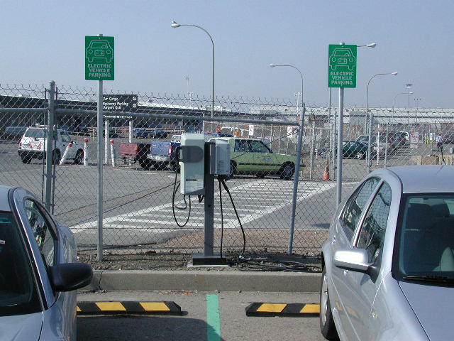
Things to do:
Oakland Terminal. See Airport Web site with maps, parking rates, etc.
by Michael Schwabe.
Generated on Sunday, 1/30/2011, at 10:45:07 PM PT from evcnall.fp7.
Revision History:
8/23/03: Revised comments.
4/30/02: added per TDdb
Do you see any discrepancies or have any information for us about this page?
Please add comments, using the EVChargerMaps system. Click here.