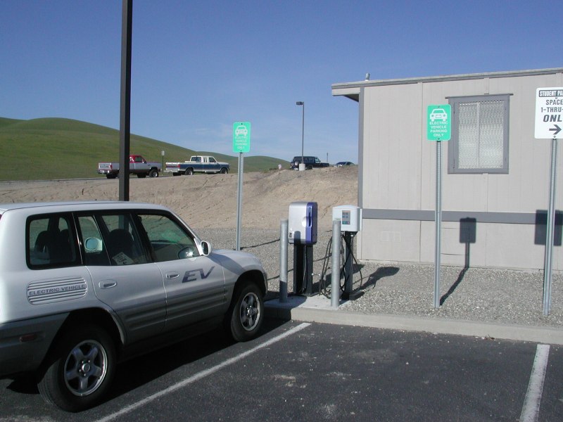
Closeup by Michael Schwabe after SPI install, 1/05.
Lat:  37.71255 (N 37°42.753') (N 37°42'45.2")   (WGS 84 datum)
Lon:-121.80011 (W121°48.007') (W121°48'0.4")
(V: Determined by GPS site visit.)
Status:
1/25/05: LPI replaced with SPI.
2002-2-24: Bay Area Air Quality Management
District, verified by Michael Schwabe.
Driving directions:
Interstate 580 to Airway Blvd north (away from Livermore Airport). At
"T" make a right onto N. Canyons Parkway. Make a left onto Collier
Canyon Rd. Follow Collier Canyon Rd until you see Los Positas'
arch and electronic sign on the right.
Go to Google Local for driving directions to/and from any location, and to find points of interest.
How to find the charging station location once you have found the site:
Enter the college and make an
immediate left. Follow the road and watch for some temporary modular
buildings at the far end of Lot F. Chargers are directly in front of
center module.
Nearby charging locations:
Use the EVChargerMaps system to find nearby charging sites, and to leave comments about this site.
Things to do:
There is a drink machine near by.
Contact information:
Jim Soles, head of Maintenance Chabot/Las Positas Community College District, cell phone is 510-715- 4234
Equipment model and serial number info:
Installed TAL S0001017 on 1/21/05. Removed GenII SM 4770 P9911 005C.
Closeup by Michael Schwabe after SPI install, 1/05.
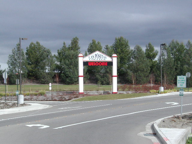
Campus entrance, by Michael Schwabe
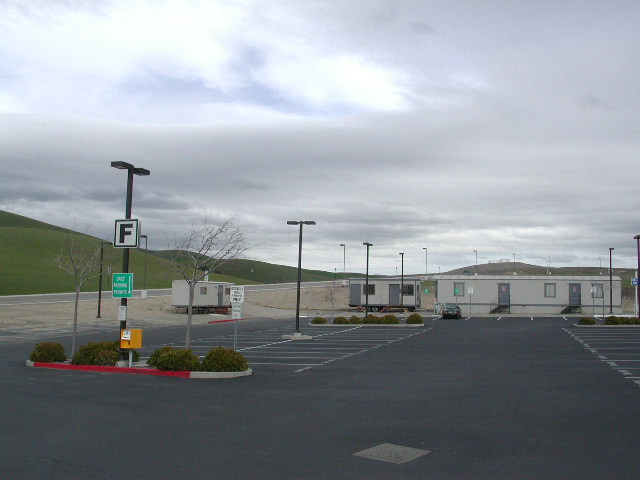
Site overview by Michael Schwabe.
Generated on Sunday, 1/30/2011, at 10:44:59 PM PT from evcnall.fp7.
Revision History:
2/3/05: Updated model and serial nos, added new photo.
1/25/05: LPI replaced with SPI as part of CARB/SMUD redeployment project.
11/6/03: Editing correction in Status field -- repair incorrect URL.
7/3/03: Revised photos
7/11/02: Corrected notes, changed 580 to 680 per Karen Casner note of 4/6/02. twd.
4/30/02: added per TDdb
Do you see any discrepancies or have any information for us about this page?
Please add comments, using the EVChargerMaps system. Click here.